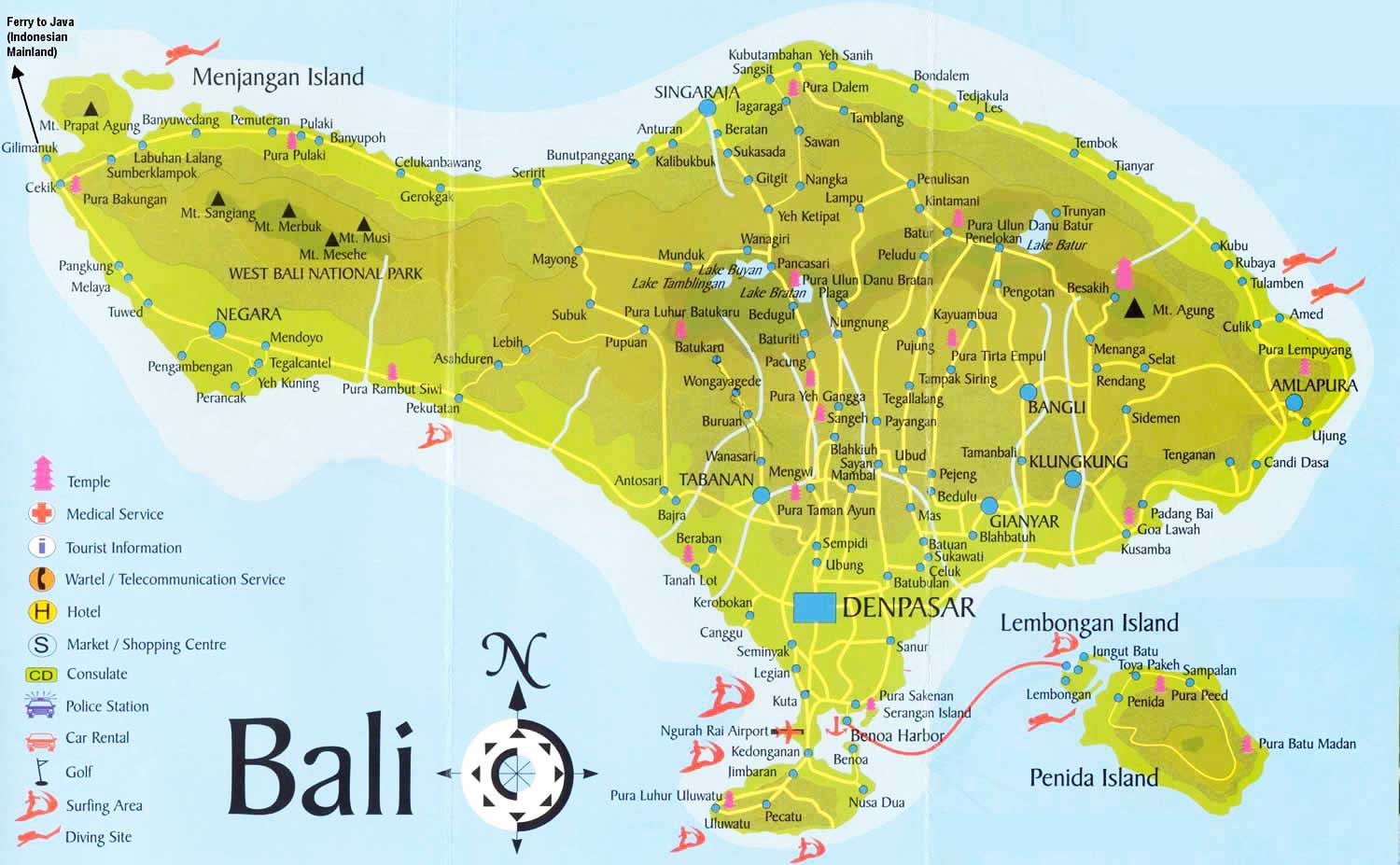
Bali Driver Tourism Map Area
Bali Driver Tourism Map Area
This Bali Driver Coverage Tourism Map Area is guiding you to discover address details of tourism sites. Through Bali Driver Tourism Maps, you will easy to locate the places that you want to go. The Bali Island is divided into eight regencies which is spread out through the island. In addition, we have divided Bali Driver Tourism Maps based on the regions that most popular as a tourist destinations. Bali Driver Tourism Map is your perfect travel guide to lead your way and find the certain locations during your vacation in Bali island.
Bali Driver Tourism Coverage Area |
|||
|
Bali North
|
Bali East
|
Bali South
|
Bali West
|
|
Lovina Beach
|
Kertagosa
|
Tanjung Benoa |
West Bali National Park
|
|
Sekumpul Waterfall
|
Goa Lawah
|
Kuta Beach |
Menjangan Island
|
|
Gitgit Waterfall
|
Amed Beach
|
Seminyak |
Medewi Beach |
|
Kroya Waterfall
|
Besakih Temple
|
Uluwatu Temple |
Rambut Siwi Temple
|
|
Banyumala Waterfall
|
Taman Ujung
|
Nusa Dua |
Tirta Samudra Dlod Brawah
|
|
Sambangan Village
|
Tulamben
|
Jimbaran |
|
|
Munduk Village
|
Padang Bai
|
Garuda Wisnu Kencana (GWK) |
|
|
Wanagiri
|
Tirta Gangga Water Palace
|
Dreamland Beach |
|
|
Twin Lake
|
Lempuyang Temple
|
Padang-Padang Beach |
|
|
Ulun Danu Bratan
|
Candi Dasa
|
Pandawa Beach |
|
|
Taman Ayun
|
Virgin Beach
|
Water Blow Peninsula Island |
|
|
Pemuteran
|
Kintamani
|
Sanur |
|
|
Tamblingan
|
|
||

